
[ Back to Home Page ] [ Park Map ] [ E-mail me ]
Click on any image for a larger view!!|
When Joe and I
began planning this trip, reading guidebooks, looking at maps etc., we knew
that we wanted to do this hike. Sevenmile hole, even the name sounded cool.
Supposedly, from this trail you can see many of the wonders of Yellowstone,
deep forest, thermal areas, the brilliant colors of the Canyon, and waterfalls.
The only issue is that the elevation difference between the beginning and the
end of the trail is 1,200 feet, totally downhill to the river and totally
uphill on the return trip. When we talked to Ben about this trip on the ride
to the trailhead, we told him that it would be a difficult climb up out of the
Canyon. His first thought was "well then, why are we doing this if it is going
to be so darn hard." He doesn't fully grasp the "because it is there"
philosophy, but I think that he is starting to get it......
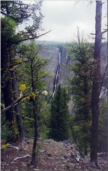
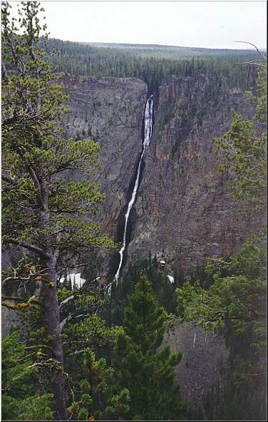
Some people say that the trail was named Sevenmile Hole because although it is only 5 miles from the trailhead to the river, it feels like 7 miles coming back up. Actually, the name refers to the fact that the end of the trail is 7 miles below the lower falls. The trail starts at the Glacier Boulder Trailhead, and remains fairly level as you walk along the edge of the Canyon. The weather was beautiful, sunny and in the 70's, as we started the hike. This area is pretty deeply forested, so views of the Canyon are difficult to come by. Peeking through the trees, and taking a very short side trail, does give up good views of the Silver Cord Cascade across the Canyon. This Cascade is interesting, because it drops 1200 feet, about the same distance you know that you will be decending, and ascending, on the Sevenmile Hole trail!
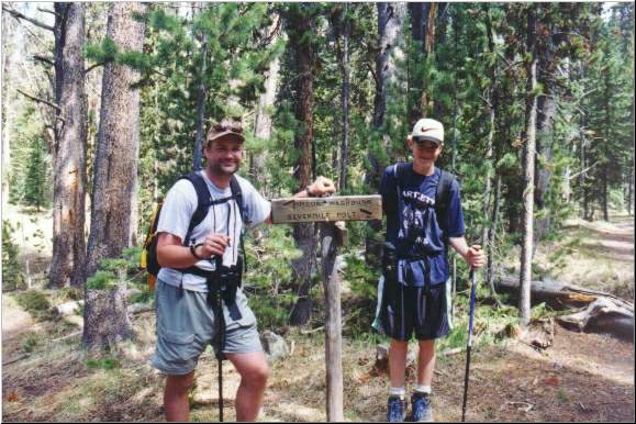
Shortly after the Silver Cord Cascade you reach the junction point with the Mount Washburn trail, which veers off to the left. The trail stays on the rim of the Canyon, and in deep forest for another mile or so. The trail at this point skirts next to a very swampy area and the trail was wet in spots. Through this area there were several large snow patches spread across the trail, so some snow play and goofing around was mandatory! Ben spent a little time spelling his name in the snow with his hiking pole.
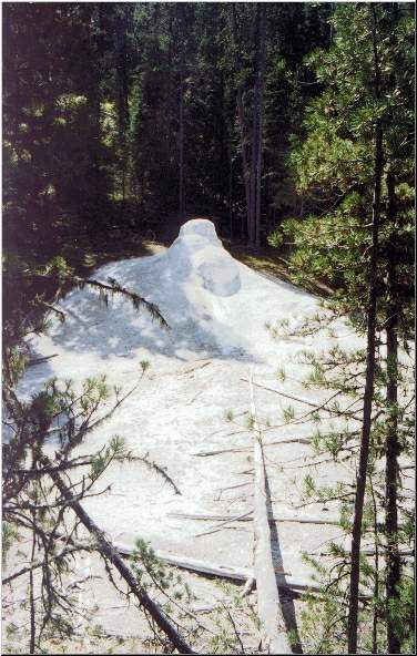
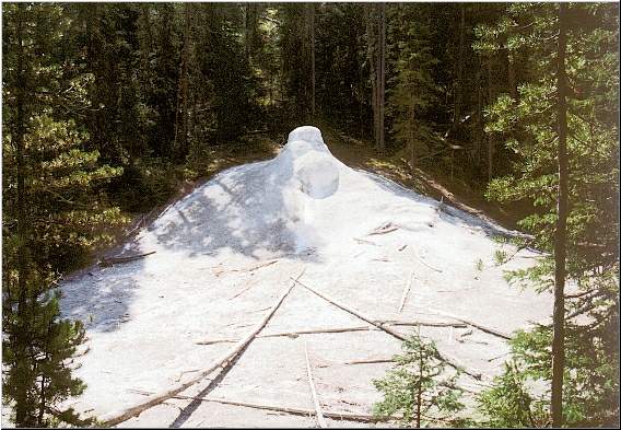
Not too far from here, the trail starts it's sharp descent into the canyon. The level, forested, dirt trail gives way to rocky switchbacks that drop rapidly through the thinning trees. Pictured below is an extinct geyser cone that just "appears" in the middle of the forest, in a small level area, in the middle of the descent. The cone was pure white, and about 8 feet tall.
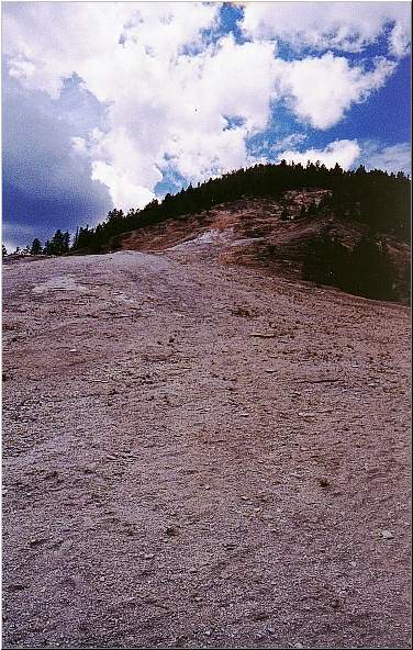
This very short level area quickly gave way to more steep descent. The trees disappeared and the terrain turned into near desert, sandy and rocky, with little vegitation. The trail passed by bubbling mud pots and you could clearly see steam vents in the area. The trail was very steep at this point, and it made me think, "this is going to be a pain on the way out". It was also quite sunny and getting very warm, probably in the mid-80s.
The disappearing trees, and change of terrain did have it's advantages. The views of the Canyon started opening up, the colors of the rock, and the waterfalls were really beautiful. Somewhere in here we met an elderly gentleman heading up, I was very impressed, I hope I can do this when I am a senior citizen.
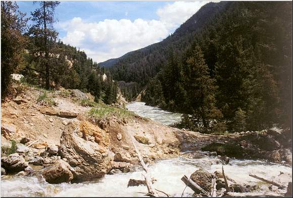
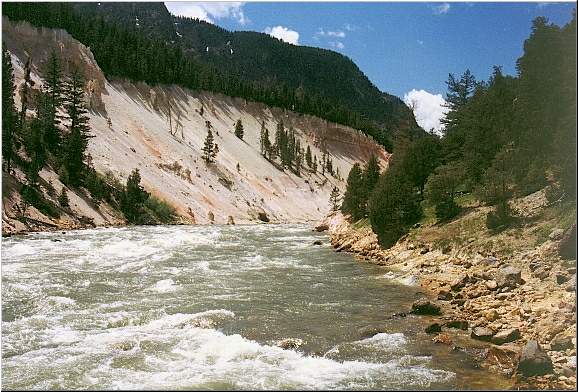
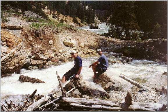
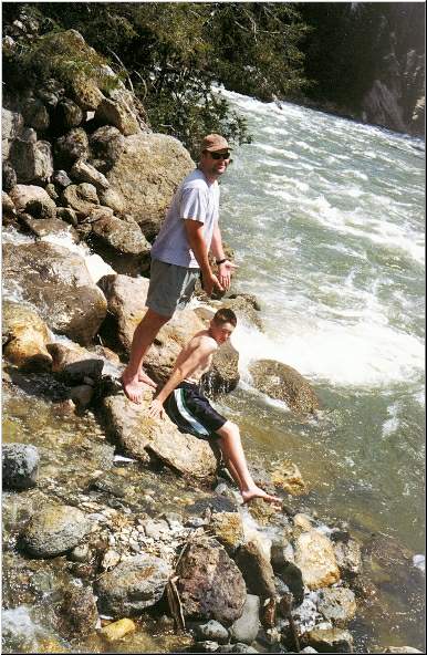
The terrain changed once more and it became forested again. The trail continued to drop as we were nearing the river. There were a couple of campsites in the area. I am not sure that I would want to camp here, there is alot of traffic on this trail and it goes virtually through the sites. We broke out through the trees and were standing on the bank of the Yellowstone River! The river was running very fast and very high. Sulpher Creek came tumbling down the canyon and met the Yellowstone right here.
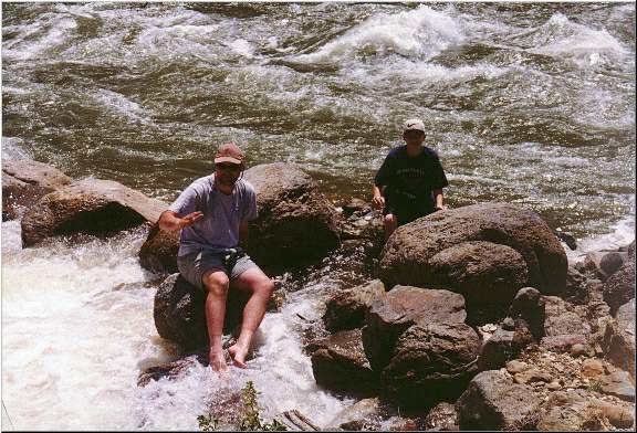
We dropped our packs and spent quite a bit of time goofing around in the creek. The Yellowstone River itself was far too fast, and too high to cool our feet. Sulpher Creek, however, was very pleasent. It was running pretty fast also, but there were alot of logs and rocks at this point, so we could sit with our feet in the cold water and relax.
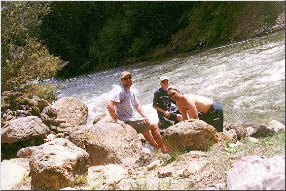
I set up the tripod and got a group shot. We had seen several people on the way down, but right now we were the only ones down here.
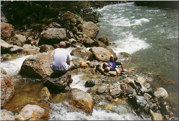
I went back up the bank a little bit to put the camera away and grab some food and water. As you can see in the picture on the left below Ben and Joe were just lazing around. As I returned with the snacks, Ben wasn't wearing his shirt and had a slightly worried look on his face. Joe was looking downriver shading his eyes from the sun. Apparently, Ben wanted to take his shirt off and get a little bit of sun. He wadded up the shirt and pitched it to the side of the creek. It must have gotten caught up in the wind because it died in mid air and settled down into the creek where it shot like a rocket towards the raging Yellowstone. Ben started to get up to go for it, Joe told him to sit down (which was a smart move, we would have been picking up the battered Ben body in Gardiner if he slipped into the Yellowstone!) Joe tells me that the shirt hit the Yellowstone, was actually pulled upstream by some weird current, and got hung up on a rock......momentarily, before it bulleted down river and out of sight forever. Ben appeared to be overly worried about losing his shirt, an inconvenience, but no big deal....until I was reminded that as we prepared for today's hike, Ben could not find an appropriate shirt, AND I LENT HIM ONE OF MINE! That was my shirt that was now halfway to Gardiner.
We stayed at the bottom for a little while longer, until a couple came down. We wanted to give them some time down here by themselves so we packed up and headed up the trail. It was very warm and sunny, I gave Ben the shirt I was wearing for the trip up and put a couple of bandanas on my shoulders under my day pack hoping that this would prevent second degree sunburn. We actually made very good time on the way up. It wasn't as steep, or as painful, as I thought it would be. We did have to stop once for several minutes because Ben got a bloody nose. Well, the only think that was available for him to use to take care of it was one of the bandanas that I was using as a makeshift shirt. We were pretty much back into the trees by then, so it wasn't a big deal. As we got near the top, it actually started clouding up. Ben was several minutes ahead of us (young legs and lungs). By the time we got back to the car it had started to rain, it was very dark and overcast, and there was lightning and thunder in the distance. There were a couple of hikers at the trailhead who were just finishing packing up their backpacks for an overnighter down Sevenmile Hole. I would not have wanted to make the descent through the steepest part of the trail, in the rain, and wind, and thunder, and lightning.......I hope that they made it down OK. |


[ Back to Home Page ] [ Park Map ] [ E-mail me ]